
Address: End of Oakmont View Drive, Glendale
Park features: Easy Hiking, Equestrian, Mountain Biking, Filming Location
The 244-acre Verdugo Mountains Open Space Preserve is located in the lushly-vegetated north-facing flank of the Verdugo Mountains in the Upper Los Angeles River Watershed in the City of Glendale. Entirely within a region designated by Los Angeles County as a Significant Ecological Area, the stunningly beautiful preserve contains more that 2,300 mature coast live oaks, sycamores, big leaf maples, bay laurels, and other indigenous trees. Numerous springs and blueline streams provide for a rich diversity of habitat. The Verdugo Mountains are unique urban mountain range comprised of 14 square miles of habitat that remain tenuously connected to the Angeles National Forest via the Big Tujunga Wash. The preserve bolsters a contiguous 4000-acre block of open space including parkland owned by the City of Glendale, the City of Burbank, the City of Los Angeles, the California Department of Parks and Recreation and the Santa Monica Mountains Conservancy. The property contains several prominent ridgelines and is highly visible from within the Rim of the Valley Trail Corridor, the 210 Freeway, and the Angeles National Forest. Equally dramatic, are the vistas from the upper slopes of the property. An extensive network of existing trails on the property, highlight its recreational value for more than one million people nearby. The property adjoins Camp Max Straus, a 112-acre resident children’s camp continuously operated by the Jewish Big Brothers of Los Angeles since 1938. The facility serves at-risk youth from all over the Los Angeles region, regardless of religious or ethnic affiliation. The City of Glendale, the Citizen’s group Volunteers Organized in Conserving the Environment (VOICE), Congressman Adam Schiff and Assemblymember Dario Frommer were instrumental in the preservation of the property. Directions: I-210 to La Crescenta Avenue south, turn right on Oakmont View Drive and drive until it deadends. The trail starts beyond the fire gate.
Trails & hiking
Featured route: Scott's Trail (trail details & live conditions on AllTrails)
- Distance: 3.1 mi (5.0 km) — Out & back
- Elevation gain: 1099 ft (335 m), high point 2483 ft
- Difficulty: Moderate
- Typical time: 2–2.5 hr
- Rating: 4.1/5 (215 AllTrails reviews)
- Good for: Hiking, Mountain biking, Trail running
- On the trail: No dogs, Views, Wildflowers, Wildlife
Conditions vary by season. Check live weather and air quality on the AllTrails trail page before heading out.
Location
End of Oakmont View Drive, Glendale
Approximate coordinates: 34.205, -118.246
View on OpenStreetMap
Photos
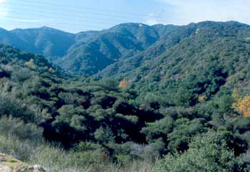
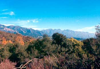
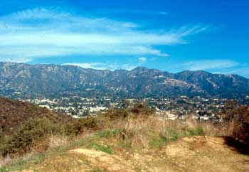
Photo credits: Rorie Skei (1-3)
Related documents
Nearby parks
Park description restored from the 2017 lamountains.com archive (Santa Monica Mountains Conservancy). Trail statistics courtesy of AllTrails. Map data © OpenStreetMap contributors.


